If you’ve ever wanted to get out and hike but felt like you didn’t know where to go or how to pack and prepare this is the perfect hiking series for you! The Finger Lakes Trail’s Hiking 101 series is designed for novice hikers of all speeds and ability levels. We’ll be in touch with you before the hike with tips about what to pack and how to dress for the weather. You will be led by experienced hikers who know the trails and want to share their love of hiking with you.
These hikes require pre-registration. They are designed for a new hiker or someone new to the area. The hike leader will explain the basics of the Finger Lakes Trail system and help familiarize the hikers to the trail. All participants should be aware that hiking trails may be slippery and have uneven terrain. Some of the hikes will have creek crossings and possibly mud. Proper sturdy hiking type footwear is advised. Wear weather appropriate clothing, the hikes are rain or shine. Bring drinking water, bug spray, and sunscreen. A snack or lunch is also recommended based on your personal needs.
Registration is for each individual hike. The registration will open approximately 3 weeks prior to the hike. A couple of days prior to the hike, registrants will receive a confirmation email with details from the hike leader. If you would like to participate in more than one hike, you must register for each hike.
Hike #1: April 12, 2025
Hike Date: April 12, 2025, Saturday
Start Time: 6 PM
FLT Map: M8
Meet Location: Garwoods United Methodist Church, 10525 County Road 15B, Canaseraga, NY 14822
(GPS: 42.459354,-77.826687)
Hike Leader: Tim Holahan
Hike Distance: 4.3 miles
Description:
How about a night hike to a hilltop vista with a full moon? There will be a micro-moon that night: the moon will be full and at its furthest from the Earth. The hilltop above Bossard’s Cabin on M08 has a spectacular 360-degree view with few or no structures in sight.
Part 1 of this hike is 2 miles with a climb of 350-400′ to the hilltop – we’ll keep a comfortable pace. Part 2 will be on a hilltop with moonrise at 7:49 pm and sunset at 7:50 pm. It’s up to each hiker to decide which way to look while we sit and enjoy the experience for an hour or more. Part 3 is our night-hike return to our cars – we’ll take our time descending the trail and enjoying moon-lit woods.
Gear choices should include warm clothes, winter hat, rain coat, a small sit-pad, snack, and a proven headlamp. This Hiking 101 is open to new hikers or to experienced hikers interested in night-hiking. Return to cars is estimated to be 10 pm – late returns happen with night hikes.
Recommendation: Wear sturdy hiking type footwear (there are tree roots, uneven ground, creek crossings, possible mud). Wear weather appropriate clothing, the hike is rain or shine. A hiking stick or pole may be helpful. Bring drinking water, bug spray, and sunscreen. A snack or lunch is also recommended. All the hikes have beautiful sights, so bring a camera/cellphone.
Hike #2: April 13, 2025
Hike Date: April 13, 2025, Sunday
Start Time: 10 AM
FLT Map: B1
Meet Location: Gannett Hill Park Drive, Naples, NY at FLT B1 Access Point 1 (GPS: 42.709141, -77.415322)
Hike Leader: Natalie Baris
Hike Distance: 4.8 miles
Description:
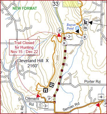
In addition to the spectacular view from the jump-off point, the hike includes the highest point on Bristol Hills Branch (2250’). Hikers will stop at the Beaver Pond lean-to and by the beaver pond.
Recommendation: Wear sturdy hiking type footwear (there are tree roots, uneven ground, creek crossings, possible mud). Wear weather appropriate clothing, the hike is rain or shine. A hiking stick or pole may be helpful. Bring drinking water, bug spray, and sunscreen. A snack or lunch is also recommended. All the hikes have beautiful sights, so bring a camera/cellphone.
Hike #3: April 19, 2025
Hike Date: April 19, 2025, Saturday
Start Time: 10 AM
FLT Map: M23
Meet Location: Fred Stewart Road & Hoag Childes Road Pharsalia, NY 13815 (GPS: 42.56462137560585, -75.69880034014517)
Hike Leader: Peg Fuller
Hike Distance: 3.5 miles
Description:
The hike will be in Pharsalia Woods along the FLT to the Sidote Bench (and the Passport rubbing station # E05) and the Sandberg Pharsalia Lean-to where we will take a short break, and then back to the cars via Fred Stewart Rd. It is a mostly level hike with slight elevation (250 ft).
Recommendation: Wear sturdy hiking type footwear (there are tree roots, uneven ground, creek crossings, possible mud). Wear weather appropriate clothing, the hike is rain or shine. A hiking stick or pole may be helpful. Bring drinking water, bug spray, and sunscreen. A snack or lunch is also recommended. All the hikes have beautiful sights, so bring a camera/cellphone.
Hike #4: April 26, 2025
Hike Date: April 26, 2025, Saturday
Start Time: 9:30 AM
FLT Map: L1
Meet Location: Visitor’s Center of Mt. Morris Dam 6103 Visitor Center Rd, Mt Morris, NY 14510 (GPS: 42.73132052997531, -77.90528823541558)
Hike Leader: Ann Bayley
Hike Distance: 4 miles
Description:
Leisurely pace, 4 miles, mostly flat, spectacular views. Comfort station and picnic tables are available for lunch. See the home office of the FLTC.
Recommendation: Wear sturdy hiking type footwear (there are tree roots, uneven ground, creek crossings, possible mud). Wear weather appropriate clothing, the hike is rain or shine. A hiking stick or pole may be helpful. Bring drinking water, bug spray, and sunscreen. A snack or lunch is also recommended. All the hikes have beautiful sights, so bring a camera/cellphone.
Hike #5: May 3, 2025
Hike Date: May 3, 2025, Saturday
Start Time: 10 AM
FLT Map: L2 & M7
Meet Location: Whiskey Bridge on River Road where the FLT crosses the Genesee River (GPS: 42.5586, -78.0479)
Hike Leader: Zach Barber
Hike Distance: 5 miles
Description:
This is a little harder of a hike but not brutal. It begins near the southern terminus of the Letchworth branch. The hike is a nice trail with bridges and gorges and a ridgeline to walk on.
Recommendation: Wear sturdy hiking type footwear (there are tree roots, uneven ground, creek crossings, possible mud). Wear weather appropriate clothing, the hike is rain or shine. A hiking stick or pole may be helpful. Bring drinking water, bug spray, and sunscreen. A snack or lunch is also recommended. All the hikes have beautiful sights, so bring a camera/cellphone.
Hike #6: May 17, 2025
Hike Date: May 17, 2025, Saturday
Start Time: 10 AM
FLT Map: B3 & HBL
Meet Location: FLT parking on Bean Station (GPS: 42.477861, -77.242159)
Hike Leader: Chris DeGolyer
Hike Distance: 3 miles
Dogs: Dogs are NOT allowed on this hike.
Description:
Meet at the FLT parking on Bean Station Rd, about 200 feet east of where the Bristol Hills Branch of the FLT crosses the road (Access point 16 on Map B3). Park on the grass on the north side of the road. We will carpool from there to the hike starting point on Glen Brook Rd (Access point 17 on Map B3). Parking is limited at both access points.
The Huckleberry Bog Nature Trail loop is a Passport Hike, and the trail is mostly flat. We’ll walk more slowly than most hikes, because we will use the nature guide to look at nature stops along the way. Highlights include bog plants, spring wildflowers, and vernal pools. The nature guides can be borrowed from the trail registers or downloaded for free.
Recommendation: Wear sturdy hiking type footwear (there are tree roots, uneven ground, creek crossings, possible mud). Wear weather appropriate clothing, the hike is rain or shine. A hiking stick or pole may be helpful. Bring drinking water, bug spray, and sunscreen. A snack or lunch is also recommended. All the hikes have beautiful sights, so bring a camera/cellphone.
Hike #7: June 1, 2025
Hike Date: June 1, 2025, Sunday
Start Time: 12:30 PM
FLT Map: M14
Meet Location: Sugar Hill State Forest Rt 21 Parking area; 3036 Co Rte 21, Watkins Glen, NY 14891 (GPS: 42.383,-76.991)
Hike Leader: Melody DeCamp
Hike Distance: 2.1 miles
Description:
This hike begins on portions of the Seneca and Mohawk trails with a gentle but noticeable incline, gaining 200 feet in elevation within the first third of a mile. The steady climb is manageable but provides a satisfying challenge as you make your way through the beautiful, wooded trail!
Should we experience an increase of rain during the spring season, we may encounter some mud which makes for a slightly slippery but fun element of the adventure. Be sure to dress your feet appropriately.
Once the initial incline is conquered, the trail flattens out, offering a peaceful stroll through the woods. About a mile into the hike, we will make our way toward the highlight of the hike: the twin lean-tos. These rustic shelters, side by side in a serene setting, are perfect for a rest, a quick snack, and a drink of water. After, we will loop back around onto the Finger Lakes Trail for the final mile hike back to our cars!
Recommendation: Wear sturdy hiking type footwear (there are tree roots, uneven ground, creek crossings, possible mud). Wear weather appropriate clothing, the hike is rain or shine. A hiking stick or pole may be helpful. Bring drinking water, bug spray, and sunscreen. A snack or lunch is also recommended. All the hikes have beautiful sights, so bring a camera/cellphone.
Hike #8: June 14, 2025
Hike Date: June 14, 2025, Saturday
Start Time: 10 AM
FLT Map: M6
Meet Location: Stickles Road, off County Route 3, Centerville-Hume Rd. (GPS: 42.471, -78.1974)
Hike Leader: Bob Schooley
Hike Distance: 3.5 miles
Description:
The hike will be in a private forest, along the FLT. It’s a beautiful hike to a huge, old Black Cherry tree. We’ll stop for a snack break at a simple camp before hiking back to the cars. It is a mostly level hike with slight elevation.
Recommendation: Wear sturdy hiking type footwear (there are tree roots, uneven ground, creek crossings, possible mud). Wear weather appropriate clothing, the hike is rain or shine. A hiking stick or pole may be helpful. Bring drinking water, bug spray, and sunscreen. A snack or lunch is also recommended. All the hikes have beautiful sights, so bring a camera/cellphone.
Hike #9: July 26, 2025
Hike Date: July 26, 2025, Saturday
Start Time: 10 AM
FLT Map: M6
Meet Location: Stickles Road, off County Route 3, Centerville-Hume Rd. (GPS: 42.471, -78.1974)
Hike Leader: Bob Schooley
Hike Distance: 3.5 miles
Description:
The hike will be in a private forest, along the FLT. It’s a beautiful hike to a huge, old Black Cherry tree. We’ll stop for a snack break at a simple camp before hiking back to the cars. It is a mostly level hike with slight elevation.
Recommendation: Wear sturdy hiking type footwear (there are tree roots, uneven ground, creek crossings, possible mud). Wear weather appropriate clothing, the hike is rain or shine. A hiking stick or pole may be helpful. Bring drinking water, bug spray, and sunscreen. A snack or lunch is also recommended. All the hikes have beautiful sights, so bring a camera/cellphone.


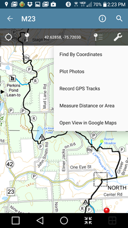


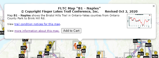

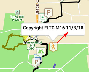
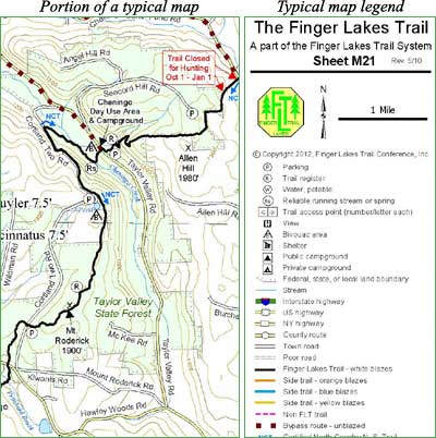
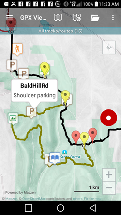
 This is an overview map of the Finger Lakes Trail System. It shows tracks of the main trail, branch trails, loops and spurs. The track colors represent the blaze colors for the branch trails, loops, spurs, and sections of the main FLT not blazed in white. Most of the main FLT is depicted in black & white for better visibility on various map backgrounds, but blazed in white on the ground. Trail closures (hunting, logging, etc.) and recommended bypass routes are depicted as shown at right. Hover over a track to display the name and length. Tracks colored
 This is a overview map of the Finger Lakes Trail System. It shows tracks of the main trail, branch trails, loops and spurs. The track colors represent the blaze colors for the branch trails, loops, spurs, and sections of the main FLT not blazed in white. Most of the main FLT is depicted in black & white for better visibility on various map backgrounds, but blazed in white on the ground. Trail closures (hunting, logging, etc.) and recommended bypass routes are depicted as shown at right. Hover over a track to display the name and length. Tracks colored
