Looking for information about Founder’s Hikes? Check out our Founder’s Hikes page.
The Founder’s Hikes (Named Hikes) will once again be held separate from the County Hike Series. Howard Beye, Erv Markert, Wally Wood, and Ed Sidote are founding members of the FLTC, and the hikes allow us to show our appreciation for everything they did so we can hike across the state. For all hikes: All participants should be aware that hiking trails may be slippery and have uneven terrain. Some of the hikes will have creek crossings and possibly mud. Proper sturdy hiking type footwear is advised. Wear weather appropriate clothing, the hikes are rain or shine. Bring drinking water, bug spray, camera/cellphone, and sunscreen. A snack or lunch is also recommended based on your personal needs.
Howard Beye: April 26, 2025
Hike Date: April 26, 2025, Saturday
Start Time: 10 AM
FLT Map: International Loop #1
Meet Location: FLT trailhead on Daisy Hollow Road North Trailhead
(GPS: 42.47078530588466, -76.2310341423272)
Hike Leader: Triple Cities Hiking Club hike leader Karen Harriell
Hike Distance: ~7 miles
Description:
Hilly terrain, Moderate pace, approximately 7 miles in the western part of the James Kennedy State Forest along a combination of the Finger Lakes
Trail and the International Trail’s Spanish Loop. The hike will follow a mix of rolling terrain and a few creek crossings. Lunch stop at picturesque Mercedes Spring. This is one of Karen’s favorite hikes, especially in early spring when wildflowers begin to appear.
Recommendation: Wear sturdy hiking type footwear (there are tree roots, uneven ground, creek crossings, possible mud). Wear weather appropriate clothing, the hike is rain or shine. A hiking stick or pole may be helpful. Bring drinking water, bug spray, and sunscreen. A snack or lunch is also recommended. All the hikes have beautiful sights, so bring a camera/cellphone.
Wally Wood: May 4, 2025
Hike Date: May 4, 2025, Sunday
Start Time: 10 AM
FLT Map: L1
Meet Location: Visitor’s Center of Mt. Morris Dam 6103 Visitor Center Rd, Mt. Morris, NY 14510 (GPS: 42.73132052997531, -77.90528823541558)
Hike Leader: Genesse Valley Hiking Club hike leader Ann Bayley
Hike Distance: 4 miles
Description:
Leisurely pace, 4 miles, mostly flat, spectacular views. Comfort station and picnic tables are available for lunch. See the home office of the FLTC. There is 2-mile extension possible.
Recommendation: Wear sturdy hiking type footwear (there are tree roots, uneven ground, creek crossings, possible mud). Wear weather appropriate clothing, the hike is rain or shine. A hiking stick or pole may be helpful. Bring drinking water, bug spray, and sunscreen. A snack or lunch is also recommended. All the hikes have beautiful sights, so bring a camera/cellphone.
Erv Markert: June 14, 2025
Hike Date: June 14, 2025, Saturday
Start Time: 9:30 AM
FLT Map: AL
Meet Location: parking area at junction of Bald Hill and Station roads in the Town of Danby (GPS: 42.318167, -76.495778)
Hike Leader: Ithaca Hikers hike leader Jim Rolfe
Hike Distance: varies; up to 8 miles
Description:
There is plenty of parking on Station Road and it gives people who want to do a shorter hike the option to bail out early, or people can do the whole
thing. The lead hike will be a 2-hour loop hike that involves walking up the seasonal part of Bald Hill Rd to the Abbott Loop to the Pinnacles. Hopefully with a good view from the observation spot at the top. The hike continues down the other side of the Pinnacles and meets the seasonal part of Bald Hill Rd. Some hikers who travel a distance to join us on this founder’s hike may want to do the entire 8+ mile Abbott Loop if they’ve never done it.
Recommendation: Wear sturdy hiking type footwear (there are tree roots, uneven ground, creek crossings, possible mud). Wear weather appropriate clothing, the hike is rain or shine. A hiking stick or pole may be helpful. Bring drinking water, bug spray, and sunscreen. A snack or lunch is also recommended. All the hikes have beautiful sights, so bring a camera/cellphone.
Ed Sidote: June 28, 2025
Hike Date: June 28, 2025, Saturday
Start Time: 8:30 AM (Longer Hike), 10 AM (Shorter Hike)
FLT Map: M23
Meet Location: Fred Stewart Road 9-mile truck trail (CCC Trail) Pharsalia, NY 13815 (GPS: 42.583567124810315, -75.70061934241754)
Hike Leader: Bullthistle hiking Club hike leaders Steve Ellsworth and Peg Fuller
Hike Distance: 5 miles (Longer Hike) 3 miles (Shorter Hike)
Description:
The hike will be in the Pharsalia Woods along the FLT to the Sidote Bench (and the Passport rubbing station # E05) and ending at the Sandberg
Pharsalia Lean-to where there will be a hotdog cookout. Hikers can bring a dish to pass (desserts, sides, etc.). Two hike distances will be offered (5-miles and 3-miles). It is a mostly level hike with slight elevation (250 ft).
Recommendation: Wear sturdy hiking type footwear (there are tree roots, uneven ground, creek crossings, possible mud). Wear weather appropriate clothing, the hike is rain or shine. A hiking stick or pole may be helpful. Bring drinking water, bug spray, and sunscreen. A snack or lunch is also recommended. All the hikes have beautiful sights, so bring a camera/cellphone.
Wally Wood is an important figure in the history of the Finger Lakes Trail Conference because without him, there would be no Finger Lakes Trail.
In the fall of 1961, Wally Wood was a long-distance hiker living in Rochester when he dreamed up the idea of a trail system across New York State. He brought the idea to the Genesee Valley Hiking Club, and a committee was established to explore the idea with like-minded hiking clubs across the state. In March of 1962, approximately 100 representatives of these clubs gathered at Keuka College for the first official meeting of the Finger Lakes Trail Conference (FLTC).
Wally Wood became the founding president of the FLTC and served in that role from 1962-1966. He served on the Board of Managers until 1969 and had many roles with the FLTC, including Bristol Hills Trail Sponsor and Trail Coordinator from 1962-1976, editor of Finger Lakes Trail News in 1969 and from 1972-1973, and executive secretary of the FLTC from 1975-1976. He was \awarded the first Wallace D. Wood Distinguished Service Award in 1984, which has since been awarded to dozens of individuals who have made significant contributions to the Finger Lakes Trail. Wally Wood passed away in 1996.
There is a monument to Wally Wood on map M7 South of Portageville. It was installed by the Hesse family, who are landowners on the FLT, and the Genesee Valley Hiking Club on June 4, 2005.
Erv Markert was chairman of the Trails Committee for almost twenty years.
Georgeana Vyverberger profiled Erv Markert for her column in the Fall 2009 issue of FLT News. The following is excerpted from her column:
“Erv Markert held the position of Trail Committee Chairman for over 20 years. That kind of dedication most likely had its effect on Howard Beye who was mentored by Mr. Markert. [When] Howard’s meticulous files were brought to the Service Center, there in the back of many of the folders was Erv Markert’s voluminous correspondence. It details beautifully the growth of a trail that was less than 50 miles on the ground when Erv took his place as Trail Manager. In June of 1964, along with some friends he flew more than 350 miles in a small plane piloted by Fred Hiltz scouting out routes in the eastern part of New York State.”
He also served as FLT president from 1971-1973. When Wally Wood retired Erv graciously made a place for the office in his home and though he recruited help for some of the endless tasks associated with record keeping, he and his family were the folks who answered the phone when anyone needed something or had a question.
Like many of the other people [Georgeanne profiled] about in [her] column, Erv heard about the trail from a news article and attended [the] first meetings. Erv and his wife Kathy met Wally Wood on the trail of the Bristol Hills Branch one day. Wally knew a good thing when he saw it because soon afterward, he knocked on the Markerts’ door and proceeded to talk Erv into taking the position of Trails Manager. During those 20 years he worked tirelessly for the FLT and was the perfect public relations liaison with the Appalachian Trail Conference and other groups.
He served on the Board of the National Trail Council, North Country Trail Advisory Board and was instrumental in the establishment of the New York State Trails Council.
In 1985 Erv was awarded the FLTC’s Wally Wood Distinguished Service Award. At the time he was still Finger Lakes Trail News editor. When asked why he became interested in the FLT his reply was simple: “I have always been interested in the outdoors but hunting and fishing didn’t answer all my needs. The Trail offered a chance for my family to do something together.”
Erv’s legacy is truly phenomenal. When he received the Wally Wood Award the main trail was 420 miles and branch trails totaled 196 miles. Most of those miles were nurtured by the intelligence and carefulness of Erv Markert.”
Howard Beye was a volunteer who literally couldn’t be replaced when he passed away suddenly in 2008 at the age of 75.
For seventeen years, the Finger Lakes Trail Conference lived in the home of Howard and Dorothy Beye. They filled orders for maps and t-shirts out of their home, managed an early iteration of the FLTC’s “database” of donors, members, and volunteers, and responded to inquiries and phone calls from trail users, sometimes at all hours of the night. In addition to managing these office functions, Howard’s official title was Trails Chair for the then 880-mile system. In this volunteer role, which he occupied for 25 years, Howard kept track of map updates, recruited and trained volunteer trail maintainers and sponsors, and tracked their volunteer hours. He also organized every Alley Cat Project each year, and managed relationships with state agencies and partners.
Howard did so much and had so many responsibilities that when he passed away suddenly in 2008, his position had to be split among several volunteers to accomplish the many tasks. It took the organization years to adjust to his absence. In some ways, the impact of Howard’s death is still being felt today.
Long-time volunteer and past FLT News Editor Irene Szabo wrote two pieces in the Winter 2008 issue of FLT News about Howard and his death. In the first, she shared the history of his involvement with the organization and predicted then just how difficult it would be for the FLTC to carry on without him, stating that it was “crushingly difficult to imagine how we will fill his shoes.”
Howard’s influence and impact on the trail were significant, but not more significant than his influence and impact on the people of the trail. In a second piece, Irene describes her relationship with Howard, who was the “first human she ever talked to about the FLTC.”
“In those days he was the only person at the other end of a phone for the whole trail, so he became THE trail to each of us,” she writes. After his death “I began to realize how thoroughly the man haunted the interior of my head. A week after he died, I was doing trail work and was amazed at how many times I caught little semi-conscious thoughts popping in unbidden, sort of an ongoing mental conversation with Howard, reporting in, so to speak, about what I was doing, how many hours I’d spent that day, what I still had to do. Even a full month later, I caught myself being faintly ashamed for Howard to see the sloppy blaze I’d just painted.”
Years later, Irene still had the feeling of “reporting in” to Howard. And it honestly sounds like he was the best kind of person to report in to. Remembering Howard Beye is a good time to remember that the trail was built and is maintained by people. It is the people and their relationships with each other that make the FLT strong and stable, and it is the people that attract other people to become involved.
In 1990, at the age of 73, Ed “Mr. FLT” Sidote became the third person to hike the entire Finger Lakes Trail. Three years later, Ed was awarded the FLTC’s Wally Wood Distinguished Service Award, and in 2004 he was the first recipient of the FLTC’s prestigious Howard Beye Lifetime Achievement Award. Ed’s contributions to the FLT were considerable and he left a lasting legacy with the FLTC.
In addition to serving as President of the FLTC’s Board of Managers, Ed left an indelible mark as the organization’s first End-to-End (E2E) Coordinator. According to FLTC-lore, if a hiker finished the FLT at 2 a.m., Ed would be there in the middle of the woods to give them their badge. Ed was also a “Trail Angel” for many hikers – giving rides in his famous Suburban – and was the creator of the FLTC’s first Trail Angel list, which was painstakingly and beautifully handwritten for hikers.
Ed was committed to the FLT hiking community, and to supporting the Finger Lakes Trail Conference. To celebrate his 90th birthday (and the FLTC’s 45th), Ed asked family, friends, and supporters of the FLTC to celebrate with a gift of $1,250 to the Finger Lakes Trail Conference. The donations could be paid all at once or over time, and all contributions would be directed to the Sidote Stewardship Fund, which is dedicated to trail protection projects. These gifts and the generous donors who made them established the FLT Forever Society, which now has 82 members and has generated more than $100,000 in donations.
A portion of trail in Chenango County is named and dedicated to Ed, and a stone bench on the trail in Pharsalia is engraved in his honor: “Ed Sidote: Mr. FLT.”
Looking for information about Yoga Hikes? Check out our Yoga Hikes Information page.
See our rules page for more information on the FLT 50/100 Challenge.
Looking for information about Hiking 101? Check out our Hiking 101 Information page.
PHOTO CREDIT: Goat Factory Media
Each year, the Finger Lakes Trail Conference offers a series of hikes across a different county along the trail. This year we are excited to be moving across the beautiful and scenic Allegany County!
In 2025 the hikes will cover approximately 60 miles of rolling hills, farmland, deep valleys, and ravines in Allegany County. In 60 miles you will hike through four State Forests and a Wildlife Management Area, and several charming hamlets.
We are offering TWO options for participation;
The County Hike Series is one of the FLTC’s most popular hiking events, and there truly is an option for everyone. Whether you are a trail runner or like to stop and smell the flowers, there will be a group to fit your desired pace!
PHOTO CREDIT: Goat Factory Media
All registrations include a 2025 Allegany County Hike Series t-shirt (adult uni-sex sizing)! Additionally, you can become a member, or renew your membership, when you register.
Registration is open for Group and Individual hikers. Founders Hikes will be separate events this year.
Participants will receive hike information, including the Allegany County Hike Series Guidebook by April 1, 2025.
The Guidebook contains detailed information about the hikes; where to meet, what to expect on hike days, etc. Everyone who registers for the Allegany County Hike Series will also be added to an email group [email protected]. This is a great place to ask questions, find carpool buddies for the hikes, etc.
Participants in the Group Hikes are split into groups based on hiking pace. Buses pick up participants at the end point in the morning and drive them to the starting point of each scheduled hike. Near the middle of the hike, a SAG Wagon is set up so hikers can refresh themselves with drinks and snacks. Hikers may choose to stop for the day at the SAG Wagon, completing a “half-hike,” and make arrangements with other half-hikers to complete the other half on another day, or to complete the hike on their own.
Hikes are scheduled for the third Saturday of each month beginning in April. The longest hike is approximately 11.9 miles and the shortest is approximately 8.5 miles. The Series concludes during the FLTC’s Fall Weekend Festival.
Date |
---|
April 19 |
May 17 |
June 21 |
July 19 |
August 16 |
September 20 |
Meeting Point | Hickory Hill Campground, Bath, NY |
---|---|
Meeting Time | 1:15 PM |
Hike Starts | Birdseye Hollow Park |
Map | M13 View MapBuy Map |
Mileage | ~3 miles |
Difficulty | Easy to Moderate |
Hike Leader | Dutch Yowell |
Description | Start at the main lot of Birdseye Hollow Park which has a pit toilet, playground, and beautiful lake. Follow park road for a short while and cross CR 96 to continue on the white-blazed main FLT. Hike through the woods to elevation of 1280 ft and descend to CR 16. Reenter woods and admire the recently cleared, impressive blowdowns from winter storms. After 0.9 miles, cross CR 16 once more and follow the park trail back to the parking lot. This trail tends to be wet. |
Meeting Point | Hickory Hill Campground, Bath, NY |
---|---|
Meeting Time | 1:00 PM |
Hike Starts | Robinson Rd. |
Map | M11 View MapBuy Map |
Mileage | 2.2 miles |
Difficulty | Easy to Moderate |
Hike Leader | Ann Bayley |
Description | On this out and back hike, enjoy farm views and beautiful woods. Hike from Robinson Rd. following farmland for a short while then enter the newly created trail in the hedgerow. Enter peaceful woods then downhill along farmland. Reach Sinclair Rd, turn around back to Robinson Rd. |
Meeting Point | Hickory Hill Campground, Bath, NY |
---|---|
Meeting Time | 1:45 PM |
Hike Starts | FLT trailhead by campsites B90 and B91 |
Map | M12 View MapBuy Map |
Mileage | Hiker preference, miniumum 2 miles |
Difficulty | Easy to Moderate |
Hike Leader | Steve Ellsworth |
Description | Head up the hill from the Hickory Hill Campground, follow the pipeline to the Hickory Hill Lean-to with possible views. Option to hike more on top of the hill to scout out more views. Then return to the lean-to and back down to the campground. |
Meeting Point | Hickory Hill Campground, Bath, NY |
---|---|
Meeting Time | 12:45 PM |
Hike Starts | Kanakadea Park |
Map | M9 View MapBuy Map |
Mileage | ~4 miles |
Difficulty | Moderate |
Hike Leader | Peter Wybron |
Description | Start at the large parking lot within the county park. Follow the white-blazed main trail west through the park with views of Almond Lake. Carefully cross Webb Crossings Rd. to access 8 and follow the path to a neat tunnel that goes under I-86. (Flashlights/Headlamps recommended). Ascend through the woods to the Old Kanakadea Lean-to for a snack break. Then descend and return to the tunnel on the park’s red-blazed trail. Return through the park. |
Meeting Point | Hickory Hill Campground, Bath, NY |
---|---|
Meeting Time | 1:30 PM |
Hike Starts | Bean Station Rd. |
Map | B3 View MapBuy Map |
Mileage | 3 miles |
Difficulty | Easy to Moderate |
Hike Leader | Chris DeGolyer |
Description | The Bristol Hills Branch Trail goes uphill through private land to Urbana State Forest, where there is a 3 mile loop trail, both orange and blue-blazed, part of which is now a nature trail intended for use with the booklets in boxes at each end of the loop. The fairly level trail (1770-1870’ elevation), entirely within Urbana State Forest, begins its north end in a patch of young maples that was open field when this trail was laid out by a Girl Scout troop in the 1960s, then turns left just beyond the junction with the blue return loop onto an old road that had four or five farms and homes along it during the 1800’s. |
Meeting Point | Hickory Hill Campground, Bath, NY |
---|---|
Meeting Time | 9:30 AM |
Hike Starts | Winding Stair Rd., carpool to trailhead |
Map | M12 View MapBuy Map |
Mileage | 2 miles |
Difficulty | Easy |
Hike Leader | John Schmitt |
Description | This is an easy 2 mile hike beginning on Winding Stair Rd and then follows an abandoned road down into a gully and up the other side. Enter the woods and continue downhill along multiple switchbacks to NY54 and Champlin Beach. This trail was built as an Eagle Scout Project in 2012 and much of the trail was built by a Girl Scout working on her Gold Badge. |
Meeting Point | Hickory Hill Campground, Bath, NY |
---|---|
Meeting Time | 9:15 AM |
Hike Starts | 1901 Dewey Rd, Hornell |
Map | M9 & M10 View MapBuy Map |
Mileage | 7.9 miles |
Difficulty | Moderate |
Hike Leader | Nathan Hayes |
Description | Start at Dewey Rd., walk the farm lane west and enjoy nice views. Pass an old barn and continue downhill near a wooded gully. Reach CR 70A, cross bridge over Big Creek, turn left off road and go steeply uphill, then along the ridgeline. Then descend steeply and enjoy the view. Continue on the roads through Hornell and onto Webbs Crossing Rd. Follow old rail bed of the Pittsburg Shawmut & Northern RR. This is part of the 1.8 mile Shawmut Hiking & Biking Trail built and maintained by the City of Hornell. Enjoy this beautiful section of trail then ascend through a combination of fields, woods, and old logging roads. Then descend to Webbs Crossing Rd., follow back to Kanakadea park. Enter the park through lovely nature trails. Bring lunch. |
Meeting Point | Hickory Hill Campground, Bath, NY |
---|---|
Meeting Time | 8:30 AM |
Hike Starts | FLT trailhead by sites B90 and B91 |
Map | M12 View MapBuy Map |
Mileage | 6.5 miles |
Difficulty | Moderate |
Hike Leader | Steve Ellsworth |
Description | his hike will head up the hill from the Hickory Hill Campground, follow the pipeline to the Hickory Hill Lean-to with possible views. Hike north on the FLT, reach register on Kershener Hill. Continue then follow Robbins Rd. for 0.3 miles before entering woods and edge of field owned by the PeaceWeavers. Ascend hill to reach the highest point on Map 12. Then return to the lean-to and back down to the campground |
Meeting Point | Hickory Hill Campground, Bath, NY |
---|---|
Meeting Time | 9:00 AM |
Hike Starts | Glenn H. Curtiss Museum |
Map | M12 View MapBuy Map |
Mileage | 3.7 miles |
Difficulty | Moderate to Hard |
Hike Leader | Kenneth Osika |
Description | The blue-blazed June Bug Trail has an elevation gain of about 669.1 ft and is rated as hard. It was developed as an Eagle project to link the Glenn H. Curtiss Museum to the Finger Lakes Trail. There are good views of Keuka Lake and Pleasant Valley. The June Bug Trail is named for an early airplane designed and built by Glenn Curtiss in 1908, with which he won the first aeronautical prize ever awarded in the USA. This trail goes uphill on town property beyond the highway garage and will eventually join the FLT at a point where there is a trail register. From this point we will turn towards Winding Stairs Rd and follow the main branch in an easterly direction. At Winding Stairs Rd we will turn downhill to the Triad Trail. The hike will end at Champlain Park, either car spot or hike along Rt. 54 to starting location. |
Meeting Point | Hickory Hill Campground, Bath, NY |
---|---|
Meeting Time | 8:45 AM |
Hike Starts | Pulver Rd. |
Map | B2 View MapBuy Map |
Mileage | 3.2 miles |
Difficulty | Moderate |
Hike Leader | Jim & Gail Davis |
Description | This hike will start at the parking area on Pulver Rd. and go through the Italy Hill State Forest. Meander through the woods, cross over small streams. Reach a gorgeous section with a small waterfall before continuing uphill, over puncheons to the Outback Inn. Then return back to the parking lot on Pulver Rd. |
Meeting Point | Hickory Hill Campground, Bath, NY |
---|---|
Meeting Time | 8:30 AM |
Hike Starts | CR13 trailhead |
Map | M12 View MapBuy Map |
Mileage | 2.5 miles |
Difficulty | Easy to Moderate |
Hike Leader | Debbie Connell |
Description | This is an easy 2.5 mile downhill hike above and along the beautiful Mitchellsville Creek gorge. The hike will begin at the top of the hill on CR13 across a farm field and past a vernal pond. You will pass a register box; (please sign in) and then a Wegmans Passport rubbing station (bring a piece of paper and a pencil to make a rubbing). Next you pass through a lovely hemlock forest along Mitchellsville Creek gorge. Once you reach the flat stream floodplain you will walk briefly on abandoned B&H railroad track, and cross Cold Brook, the inlet for Keuka Lake, on a bridge built by an Alley Cat Crew in 2001. Follow the trail along the edge of a vineyard to CR88, Pleasant Valley Road, and to the trailhead at Town of Urbana Town Hall. |
Meeting Point | Hickory Hill Campground, Bath, NY |
---|---|
Meeting Time | 9:00 AM |
Hike Starts | M13 access 1, Birdseye Hollow Rd. |
Map | M12 & M13 View MapBuy Map |
Mileage | 2.2 miles |
Difficulty | Easy to Moderate |
Hike Leader | Mike Cunningham |
Description | Start at the shoulder parking at map 13 access 1. Head west on white-blazed FLT, over two bridges that were built by an AlleyCat crew. Ascend through the woods, reaching N. Urbana Rd. then return down the hill back to Birdseye Hollow Rd. |
Meeting Point | Hickory Hill Campground, Bath, NY |
---|---|
Meeting Time | 8:45 AM |
Hike Starts | Access 5D (Blue Trail) parking lot |
Map | B1 View MapBuy Map |
Mileage | ~3 miles |
Difficulty | Moderate to Hard |
Hike Leader | Steve Ellsworth |
Description | From Parish Hill Rd parking lot, take the blue/yellow trail uphill. Then descend on stairs to the stream. Cross over a bridge dedicated to the memory of Tom Noteware. Go uphill to views of the gorge and hills to the west. After a little more uphill, come to junction with yellow trail to the right. Follow this trail along the gorge and down steeply to CR245, enjoy the views along the way. Take road back to car or car spot at this point. |
New This Year – Help Support the Trail with Every Step!
The FLT50 and FLT100 hiking challenges are back for 2025! This year, we’ve added an optional fundraising component, allowing participants to support the trail with every step.
Share your stories and photos. Please tag them @fingerlakestrail and use the hashtags #FLT50, #FLT100, and #fingerlakestrail. We will use some of them in Footnotes, FLT News, and other promotional materials.
We look forward to your participation and can’t wait to hear about your adventures!
Use this registration form if you wish to be a participant and hike either 50 or 100 miles.
Use this registration form if you are sponsoring a participant hiker.
Looking for a way to track your miles? We have you covered. You can download our handy mileage tracking sheet. We offer both PDF and Excel Spreadsheet versions.
The online mileage submission form will be available soon.
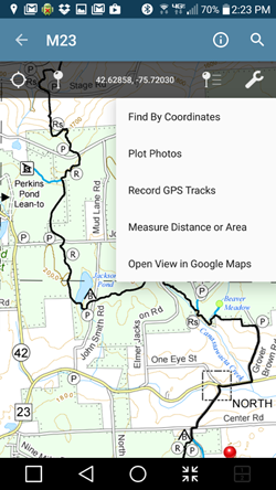
PDF map files available for download from the FLTC On-line Store are geospatial-enabled. This means that the files can be imported into mapping software available for many Apple and Android smart phones and tablets, and soon for Windows Phones.
We have tested our PDF maps with the Avenza PDF Maps Mobile App. Once you have installed this (free) app on your device, you can import the FLTC PDF map into the application.
Then, when you are hiking within the boundaries of the map, you can see your location acording to your device’s GPS. You can also do things like:
The free version of the Avenza app will only permit you to import three maps at one time. To import an additional map, you must first remove one of the three from the app. You can still keep the PDF files on your device and switch them at any time. There is a subscription version available from Avenza that will permit you to import an unlimited number of maps.
You can also purchase PDF versions of FLT maps from Avenza, and for purchased maps, there is no limit to the number you can import.
Consult with this page for notices of trail conditions before you leave for your hike. Click on the “Sort by” option to sort the notices by map name or by date. Don’t know your map name? Go to the index map look for the name (M09 or M9 for example) nearest your hike location.
When sorted by map name, the notices are listed going from west to east on the main trail, and then north to south on the branch trails (south to north on Conservation and Onondaga trails). Click on the map names above the table to jump to the notices for a particular map. You can then scroll up and down to view other nearby notices.
The date of the most recent major revision is shown for each map. Check the revision date on your map to see if it might be outdated. All changes to maps—both major revisions and minor updates—are reported as Trail Notices highlighted in pink. Use these notices to decide when you want to replace an outdated map.
When sorted by Date the notices are listed with the most recent notices anywhere on the FLTC system listed first.
Some older notices have been archived as they may contain information that is still useful if you have not visited the trail recently. Click the “Archived” link to view these notices.
Trail conditions change frequently. You can help by reporting problems you see. But please read How to Report Trail Conditions before submitting your report.
Trail Conditions are posted when reported and verified. Conditions are rectified if and when volunteers are available.
The FLT is a “primitive footpath.” If you are looking for a smooth, easy “walk in the park” then you might prefer a park for your walking. On the other hand, if you are looking to challenge yourself and get away from “engineered” experiences, then come to the Finger Lakes Trail.
Nevertheless, we want the condition of the Finger Lakes Trail to be the best it can be. Every section of the trail is maintained by stewards and trail adopters who are members of the FLTC and affiliate clubs and organizations. These people volunteer their time because they care about the Finger Lakes Trail. They also care about your experience on the trail. They visit their section of trail several times each year to look for problems: trail erosion, litter, vegetation infringement on the trail, fallen trees and branches, blazes and signs that need to be replaced or refreshed, and infrastructure that needs repair. In short, they look for things that will interfere with your wilderness hiking experience.
Trail volunteers also interact with our private landowners who have agreed to share a portion of their property with FLT hikers. Our volunteers are the first to know when land ownership may change, or when the landowner has had a problem on their section of trail.
Whether you are a new or experienced hiker, if you find a problem on the trail, let us know! Visit the Trail Condition Reporting page for more information.
Remember, some sections of the trail are closed during hunting seasons which include Spring and Fall turkey seasons, and Fall big game seasons. Closures are listed in red in the Trail Condition Notices. Dates are listed on Hunting Season Schedules.
And, when you are ready, join us as a volunteer to help keep the Finger Lakes Trail one of the best hiking trails in the world.
We revise paper maps, PDF files, and GPX files when trail conditions change significantly. When we do, we change the Revision Date of the map. We also apply minor updates to our maps as needed, and for these, we do not change the Revision Date. For all map changes, we post a Map Revision Notice on the Trail Condition Notices page on the website. You can use both the revision date and the Map Revision Notices to decide if you want to purchase a fresh copy of a map.
We do not change our maps for temporary conditions such as logging closures, storm damage, or special events, but we do post Trail Condition Notices.
We encourage hikers to always check the Trail Condition Notices page before hiking even if their maps are up to date. Here is a short tutorial:
We hope that this information will help you keep your maps and understanding of trail conditions up to date for the most satisfying and safe experience on the Finger Lakes Trail.
The interactive maps may not display correctly in some browsers. For best results, use Firefox, Chrome, Edge, or Safari. If you are having trouble, try the segmented version of the map here. |
This is an overview map of the Finger Lakes Trail System. It shows tracks of the main trail, branch trails, loops and spurs. The track colors represent the blaze colors for the branch trails, loops, spurs, and sections of the main FLT not blazed in white. Most of the main FLT is depicted in black & white for better visibility on various map backgrounds, but blazed in white on the ground. Trail closures (hunting, logging, etc.) and recommended bypass routes are depicted as shown at right. Hover over a track to display the name and length. Tracks colored magenta and labeled “Non-FLT” show approximate location only and may not represent the condition and location of the trail on the ground.
When you zoom in on a trail section, trailheads, notices, and important infrastructure such as lean-tos are also shown.
![]() |
Click the menu button in the upper right for commands to Change the map background and Adjust map opacity, |
![]() |
Click the button in the upper right to view the map in the full window. Then click the geolocate button to show your present GPS location on the map. |
The following symbols appear on the map (use the Hide/Show Symbols menu in the upper right to control symbol visibility): | |
![]() |
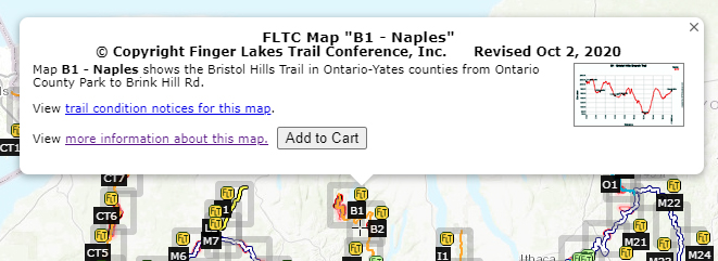
Information about FLTC Maps, ![]() Also, connect to Trail Condition Notices directly from the ![]() |
![]() |
Trailhead with parking. Click the symbol for more information and for driving directions. |
![]() |
Parking prohibited by law or landowner request. |
![]() |
Parking Advisory – Limited or poor parking; some have nearby alternatives. |
![]() |
Camping, including lean-tos, bivouac sites, public and private campgrounds. See Lean-tos, Bivouac Areas, and Campgrounds for more information |
![]() |
Hunting closures. See Hunting Season Schedules for more information. |
![]() |
Potable water |
![]() |
Water source – TREAT BEFORE DRINKING |
![]() |
FLT Passport hike is nearby. Click the icon to view details, obtain a map, or obtain the guidebook. |
![]() |
Google street view. Drag the icon onto highlighted streets and click. (For more information) |
½-mile tickmark – hover over a tickmark to display the mileage along the trail segment (Use Hide/Show Symbols menu to show the tickmarks). | |
![]() |
Connections to other long-distance hiking trails. |
![]() |
Enter GPS coordinates (Latitude, Longitude) or an address (street address, town, or zip code) and click Find to recenter the map at that location. |
![]() |
Click on the center tool to show a small cross-hair in the center of the map. The tool shows the coordinates of the center if you pan or scroll the map. |
The interactive maps may not display correctly with Internet Explorer. For best results, use Firefox, Chrome, Edge, or Safari. If you have a fast computer and fast network connection, you can try the unsegmented Full System version of the map here. |
This is a overview map of the Finger Lakes Trail System. It shows tracks of the main trail, branch trails, loops and spurs. The track colors represent the blaze colors for the branch trails, loops, spurs, and sections of the main FLT not blazed in white. Most of the main FLT is depicted in black & white for better visibility on various map backgrounds, but blazed in white on the ground. Trail closures (hunting, logging, etc.) and recommended bypass routes are depicted as shown at right. Hover over a track to display the name and length. Tracks colored magenta and labeled “Non-FLT” show approximate location only and may not represent the condition and location of the trail on the ground.
When you zoom in on a trail section, trailheads, notices, and important infrastructure such as lean-tos are also shown.
![]() |
Click the menu button in the upper right for commands to Change the map background and Adjust map opacity, |
![]() |
Click the button in the upper right to view the map in the full window. Then click the geolocate button to show your present GPS location on the map. |
The following symbols appear on the map (use the Hide/Show Symbols menu to control symbol visibility): | |
![]() |
Click for information about FLTC Maps, ![]() ![]() |
![]() |
Trailhead with parking. Click the symbol for more information. GPS coordinates, and for driving directions. |
![]() |
Parking prohibited by law or landowner request. |
![]() |
Parking Advisory – Limited or poor parking; some have nearby alternatives. |
![]() |
Camping: lean-tos, bivouacs, public and private campgrounds. See Lean-tos, Bivouacs, and Campgrounds for more information |
![]() |
Hunting closures. See Hunting Season Schedules for more information. |
![]() |
Potable water ![]() |
½-mile tickmark – hover over a tickmark to display the mileage along the trail segment (Use Hide/Show Symbols menu to show the tickmarks). | |
![]() |
Connections to other long-distance hiking trails. |
![]() |
Enter GPS coordinates (Latitude, Longitude) or an address (street address, town, or zip code) and click Find to recenter the map at that location. |
![]() |
Click on the center tool to show a small cross-hair in the center of the map. The tool shows the latitude and longitude coordinates of the center if you pan or scroll the map. |
![]() |
Select a map background from the list in the upper right. Use the menu icons to find tools to measure distance and control background opacity. |
As a trail Section Maintainer (called Steward or Adopter by some clubs) you assume responsibility for a section of the Finger Lakes Trail, generally 1 or 2 miles in length. Working for your club or trail sponsoring organization, or as an individual trail sponsor under one of the FLTC’s volunteer Regional Trail Coordinators, you agree to visit your section three times per year. You perform routine inspection and maintenance: clear vegetation and fallen branches, pickup litter, refresh blazes and signs as needed, check up on trail infrastructure such as register boxes, benches, bridges, lean-tos, etc.
To access the services of a roving certified chainsaw operator or for anything else you can’t handle yourself, you will contact your club or organization’s trails chairperson, or the FLTC’s Regional Trail Coordinator who oversees your area. They will help you organize a work day with a local work crew.
You will keep a log of your activities and report total hours of trail work, drive time, and administrative work, and report it to your trails chairperson or sponsor.
You will also be invited to attend occasional training meetings in your region.
Since our volunteer trail maintainers don’t visit the trail every day, we depend on you to notice and report trail conditions that need to be corrected. It could be a safety issue or just an inconvenience, but let us know about it. On the other hand, remember that the Finger Lakes Trail is a “primitive footpath” so that some conditions such as a steep rocky section, an occasional “step-over” log, or a section that is muddy in some seasons, are a natural part of the experience.
Please submit your trail condition reports by e-mail at [email protected]. If you do not have e-mail, call the FLT Service Center in Mount Morris at (585)658-9320. During times when the office is not open, please leave a voice message with a daytime phone number where we can reach you for more information.
Describe the problem clearly, being as specific as possible as to the location and nature of the problem. Include as much of the following as possible:
Give your best estimate of what is needed to correct the problem; we hate to send a crew with chainsaws only to find a small tree that could have been handled by one person with a handsaw.
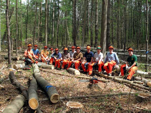
FLTC volunteers attend 2-day training course in safe and efficient use of chainsaws for clearing blowdown
on the Finger Lakes Trail – Photo R. Hopkins
The interactive maps may not display correctly with Internet Explorer. For best results, use Firefox, Chrome or Safari. |
This is an overview map of the portion of the North Country National Scenic Trail carried on the Finger Lakes Trail System. It shows only the main route of the NCNST; branches, loops, and spurs are not shown. The main FLT trail section is depicted in black for better visibility on various map backgrounds, but blazed in white on the ground. The Onondaga Trail section is depicted in blue and blazed in blue. Trail closures (hunting, logging, etc.) and recommended bypass routes are depicted as shown at right.
When you zoom in on a trail section, trailheads, notices, and important infrastructure such as lean-tos are also shown.
![]() |
Click the menu button in the upper right for commands to Change the map background and Adjust map opacity, |
![]() |
Click the button in the upper right to view the map in the full window. Then click the geolocate button to show your present GPS location on the map. |
The following symbols appear on the map (use the Hide/Show Symbols menu to control symbol visibility): | |
![]() |
Click for information about FLTC Maps, ![]() ![]() |
![]() |
Trailhead with parking. Click the symbol for more information. GPS coordinates, and for driving directions. |
![]() |
Parking prohibited by law or landowner request. |
![]() |
Camping: lean-tos, bivouacs, public and private campgrounds. See Lean-tos, Bivouacs, and Campgrounds for more information |
![]() |
Hunting closures. See Hunting Season Schedules for more information. |
![]() |
Potable water ![]() |
½-mile tickmark – hover over a tickmark to display the mileage along the trail segment (use Hide/Show Symbols menu to show the tickmarks) | |
![]() |
Connections to other long-distance hiking trails. |
![]() |
Enter GPS coordinates (Latitude, Longitude) or an address (street address, town, or zip code) and click Find to recenter the map at that location. |
![]() |
Click on the center tool to show a small cross-hair in the center of the map. The tool shows the latitude and longitude coordinates of the center if you pan or scroll the map. |
![]() |
Select a map background from the list in the upper right. Use the menu icons to find tools to measure distance and control background opacity. |
Current members of the Finger Lakes Trail are entitled to discounts on maps, stickers, and patches for sale on this website. A member coupon code is also provided for clothing and logo merchandise on the third-party website.
If your membership is current, you should see the symbol on discounted products. If you do not see this, please add this ($0.00) product to your EMPTY shopping cart. Then checkout. Log out of the website, log back in, and return to the store. You should now see the discount symbol and see discounted prices on your purchases.
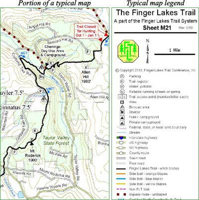
Download a sample paper map in PDF form here.
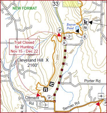
The following are examples from a typical map:
CLASS OF 2024 | CLASS OF 2023 | |
Ann Bayley | Donna Flood | |
Lisette Brennan | Sharon Ray | |
Christine DeGolyer | Willa Powell | |
Tim Holahan | ||
Terry Meacham | ||
CLASS OF 2022 | CLASS OF 2021 | CLASS OF 2020 |
Peg Fuller | Ann Bayley | Donna Flood |
Scott Geiger | Rich Breslin | Laurie Ondrejka |
Roger Hopkins | Scott Brooks | Mike Ogden |
Tim Sweeney | Terry Meacham | Dave Newlun |
Peter Wybron | ||
CLASS OF 2019 | CLASS OF 2018 | CLASS OF 2017 |
Roger Hopkins | Scott Brooks | Michael Ogden |
Tim Sweeney* | Bob Kremens | Debra Nero |
David Tuttle | Terry Meacham | Sieglinde Schwinge |
Laurie Ondrejka | Wendy Stevenson | |
Anna Keeton* | Donna Flood* | |
CLASS OF 2016 | FUN CLASS OF 2015 | CLASS OF 2014 |
Cate Concannon | Scott Brooks | Scott Bahantka |
David Drum | Donna Coon* | Jon Bowen |
Donna Flood | Roger Hopkins | Donna Cole |
Roger Hopkins* | Terry Meacham | Melanie Okoniewski |
David Tuttle | Laurie Ondrejka | Sigi Schwinge |
CLASS OF 2013 | CLASS OF 2012 | CLASS OF 2011 |
Cathy Concannon | Patricia Haynes | Jon Bowen |
Phil Dankert | Roger Hopkins | Bill Coffin |
David Drum | Phil Metzger | Terry Meacham |
Donna Flood | John A-X Morris | Ray Recchia |
Gail Merian | Ken Reek | Sigi Schwinge |
CLASS OF 2010 | CLASS OF 2009 | CLASS OF 2008 |
Phil Dankert | Richard Breslin | Dawn Bennett |
Cheryl Peluso | Vicky Gaeta | Linda Cruttenden |
Georgeanne Vyverberg | John A-X. Morris | Scott Lauffer |
George Zacharek | Irene Szabo | Terry Meacham |
Jacqui Wensich |
*Appointed
The FLTC offers downloadable files containing complete track and complete waypoint GPS data detailing all of the approximately 1,000 miles of the FLT, including main, loop, branch, and spur trails. In addition to GPS data, the downloadable files contain PDF images of the paper maps. GPS data is in the form of GPX files that can be loaded onto smart phones supporting GPX apps.
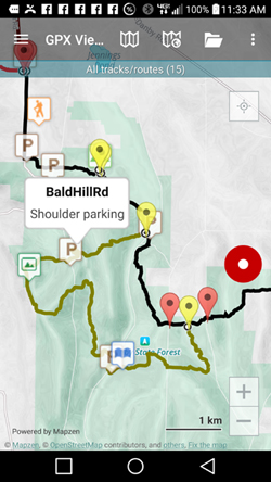
The free GPX Viewer from Vectura will enable you to view our maps on your Android phone. Tracks and waypoints are displayed on a variety of on-line map backgrounds along with your present location.
GPX Viewer Pro (license fee) has all of the features of GPX Viewer plus you can record the track of your hike. You can also download background maps to your device that can be viewed during your hike even if you have no cell phone coverage.
If you have experience using other smart phone apps, please let us know at [email protected].
The FLTC offers downloadable files containing complete track and complete waypoint GPS data detailing all of the approximately 1,000 miles of the FLT, including main, loop, branch, and spur trails. In addition to GPX data, the downloadable files contain PDF images of the paper maps. GPX files can be loaded onto color “field” (i.e. hiking, as opposed to automotive) GPS units. These GPX files can also be opened in Google Earth, so that you can view your hikes ahead of time (you can download the necessary software from Google Earth for free).
Detailed instructions for using the Track and Waypoint data in these GPX files are provided here.
Instructions for using the data with these recommended Garmin GPS units are also included:
Recent Garmin units: 62, 78, Oregon, Dakota, and Colorado. The Oregon and Dakota models are “touch screen” units (similar to auto GPS units) amd may be a little easier to learn how to use.
Older Garmin units: 60, 78 (instructions can also be used with Etrex Vista HCx and Etrex Legend HCx with slight modifications).
Bottom Line Recommended Unit? If you are a “techie” and can find it, grab the 60CSx at the present discounted prices. If you are a “newbie” you might prefer the touch screen Dakota or Oregon units (the Oregon 550 models can also take geotagged [lat-long embedded] photos).
Unless you have one of the recent Garmin units that has preloaded topo maps (indicated with a “t” at the end of the model number) you will want to download free topo maps for Garmin GPS units from GPS File Depot or other web sites. You can also purchase Garmin Topo U.S. 100K or similar Garmin software on DVD or micro SD card, but these can be expensive.
Delorme Units: These data also work with the Delorme GPS units PN-20 and PN-40, if you also have Delorme Topo software. However, expect loss of track and waypoint attributes (such as colors and symbols) with these and other GPS units that are not in the above recommended list.
Other Units: These GPX files may be compatible with other GPS units, but we have tested these files only with the recommended units listed above. If you are using another unit, it is up to you to determine that your GPS unit can use this GPX data. Before ordering the digital download map files, try downloading this sample GPX file, M09.gpx (our map M9), to ensure that it is compatible with your hardware and software.
As a Local Work Crew member you will join other volunteers recruited to work on trail projects that are beyond routine maintenance and the capabilities of the individual trail section adopter/steward. Projects might be repairing trail erosion, clearing downed trees, repairing bridges and structures, and the like. Projects are usually one day or less. Work parties are typically organized by the club or organization sponsoring the section or by the FLTC’s Regional Trail Coordinator for the area.
Many of our Local Work Crew members also have their own trail section they maintain.
Trail work projects are announced by e-mail and by local websites and newsletters. Let your trails chairperson, trail sponsor, or regional trail coordinator know if you will join the crew as this will greatly help with planning.
Your trails chairperson, trail sponsor, or regional trail coordinator will be responsible for reporting total hours of trail work, drive time, and administrative time.
To join your local trail work crew, simply contact your trails chairperson, trail sponsor, or regional trail coordinator and get your name on the distribution list.