How to use this page
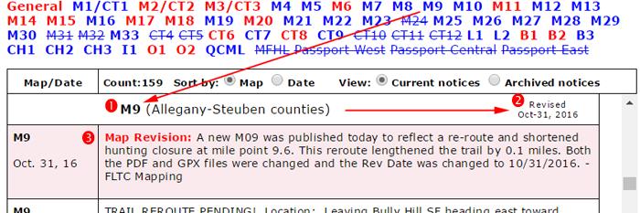
Consult with this page for notices of trail conditions before you leave for your hike. Click on the “Sort by” option to sort the notices by map name or by date. Don’t know your map name? Go to the index map look for the name (M09 or M9 for example) nearest your hike location.
When sorted by map name, the notices are listed going from west to east on the main trail, and then north to south on the branch trails (south to north on Conservation and Onondaga trails). Click on the map names above the table to jump to the notices for a particular map. You can then scroll up and down to view other nearby notices.
- Map names in red indicate that one or more notices for that map contain hunting notices or other temporary trail closures. Check carefully for these notices during hunting season(s) in your area.
- Map names underlined in gray have no notices.
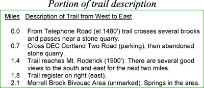
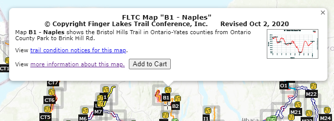
The date of the most recent major revision is shown for each map. Check the revision date on your map to see if it might be outdated. All changes to maps—both major revisions and minor updates—are reported as Trail Notices highlighted in pink. Use these notices to decide when you want to replace an outdated map.
When sorted by Date the notices are listed with the most recent notices anywhere on the FLTC system listed first.
Some older notices have been archived as they may contain information that is still useful if you have not visited the trail recently. Click the “Archived” link to view these notices.
More about trail conditions
Trail conditions change frequently. You can help by reporting problems you see. But please read How to Report Trail Conditions before submitting your report.
Trail Conditions are posted when reported and verified. Conditions are rectified if and when volunteers are available.
The FLT is a “primitive footpath.” If you are looking for a smooth, easy “walk in the park” then you might prefer a park for your walking. On the other hand, if you are looking to challenge yourself and get away from “engineered” experiences, then come to the Finger Lakes Trail.
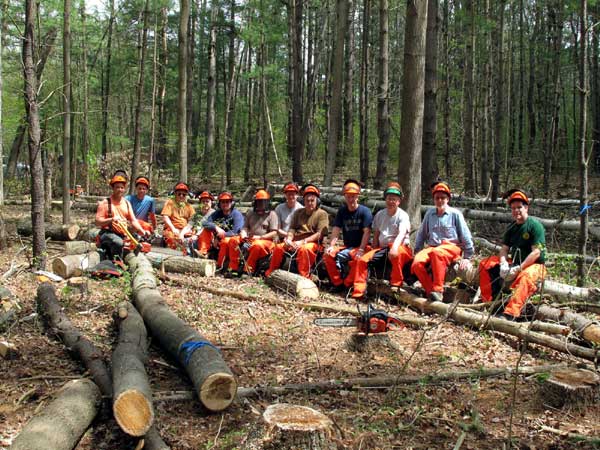
Nevertheless, we want the condition of the Finger Lakes Trail to be the best it can be. Every section of the trail is maintained by stewards and trail adopters who are members of the FLTC and affiliate clubs and organizations. These people volunteer their time because they care about the Finger Lakes Trail. They also care about your experience on the trail. They visit their section of trail several times each year to look for problems: trail erosion, litter, vegetation infringement on the trail, fallen trees and branches, blazes and signs that need to be replaced or refreshed, and infrastructure that needs repair. In short, they look for things that will interfere with your wilderness hiking experience.
Trail volunteers also interact with our private landowners who have agreed to share a portion of their property with FLT hikers. Our volunteers are the first to know when land ownership may change, or when the landowner has had a problem on their section of trail.
Whether you are a new or experienced hiker, if you find a problem on the trail, let us know! Visit the Trail Condition Reporting page for more information.
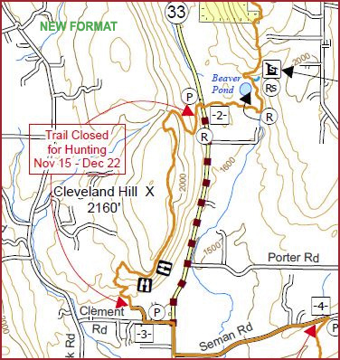
Remember, some sections of the trail are closed during hunting seasons which include Spring and Fall turkey seasons, and Fall big game seasons. Closures are listed in red in the Trail Condition Notices. Dates are listed on Hunting Season Schedules.
And, when you are ready, join us as a volunteer to help keep the Finger Lakes Trail one of the best hiking trails in the world.
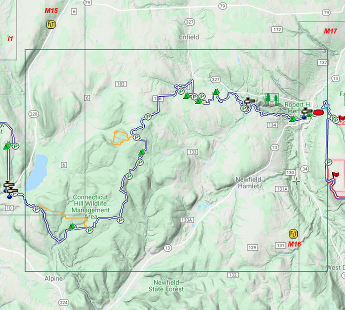


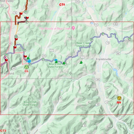
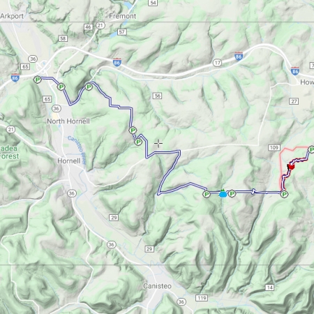


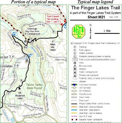
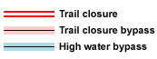 This is an overview map of the Finger Lakes Trail System. It shows tracks of the main trail, branch trails, loops and spurs. The track colors represent the blaze colors for the branch trails, loops, spurs, and sections of the main FLT not blazed in white. Most of the main FLT is depicted in black & white for better visibility on various map backgrounds, but blazed in white on the ground. Trail closures (hunting, logging, etc.) and recommended bypass routes are depicted as shown at right. Hover over a track to display the name and length. Tracks colored
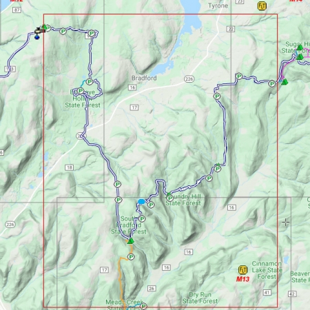
 This is a overview map of the Finger Lakes Trail System. It shows tracks of the main trail, branch trails, loops and spurs. The track colors represent the blaze colors for the branch trails, loops, spurs, and sections of the main FLT not blazed in white. Most of the main FLT is depicted in black & white for better visibility on various map backgrounds, but blazed in white on the ground. Trail closures (hunting, logging, etc.) and recommended bypass routes are depicted as shown at right. Hover over a track to display the name and length. Tracks colored