We have lots ways to help you find the trail including maps, guidebooks, track and waypoint data for your handheld GPS unit, and free trailhead parking coordinates for your automobile GPS. To get a general overview of the trail for planning your hike, you can also use the Interactive Map of the FLT System.
Maps
The Finger Lakes Trail is composed of many segments, each covered by its own official FLTC map.

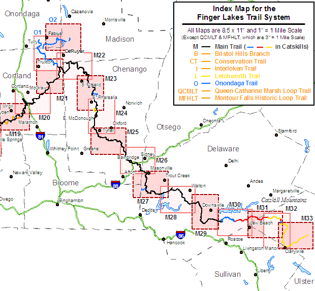
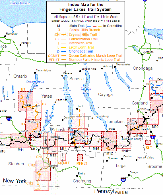
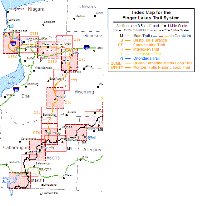
The maps of the Finger Lakes Trail System are named as follows:
| Main Trail and Branch Trails (1 inch = 1 mile) | |
|---|---|
| Trail Name | Map Names |
| Main Finger Lakes Trail* | M1, M2, …, M34 |
| Conservation Branch Trail* | CT1, CT2, …, CT12 |
| Letchworth Branch Trail | L1, L2 |
| Bristol Hills Branch Trail | B1, B2, B3 |
| Crystal Hills Branch Trail | CH1, CH2, CH3 |
| Interloken Branch Trail | I1 |
| Onondaga Branch Trail | O1, O2 |
| North Country National Scenic Trail on the FLT* | M1, M2, …, M22, O1, O2 |
| *The Main Trail and the Conservation Branch Trail are the same on the first three maps: M1/CT1, M2/CT2, and M3/CT3. The portion of the NCNST in New York State carried on the FLT is shown on the maps indicated above. | |
| Loop Trails (1 inch = 1/3 mile or less) | |
| Trail Name | Map Name |
| Huckleberry Bog Loop | HBL (part of B3) |
| Pinnacle S. P. – McCarthy Hill S. F. Loops | PMHL (part of CH2) |
| Queen Catherine Marsh Loop Trail | QCML |
| Montour Falls Historic Loop Trail | MFHL |
| Abbott Loop | AL (part of M17) |
| International Loops One (German, International, Spanish, Swedish, and Ukrainian Loops) | InL1 (part of M19) |
| International Loops Two (English Loop, Irvin Trail, and several smaller connected trails) | InL2 (part of M19) |
| International Loops Three (Irish and Lithuanian Loops) | InL3 (part of M19) |
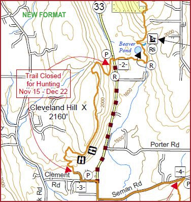
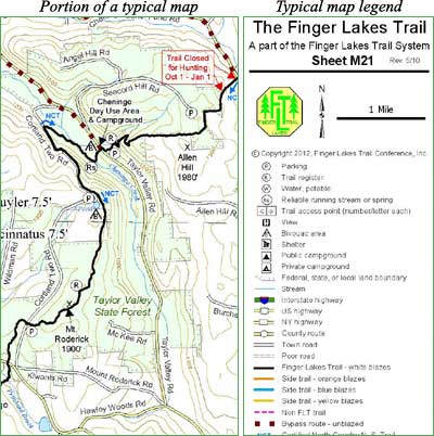
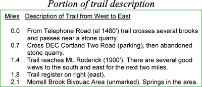
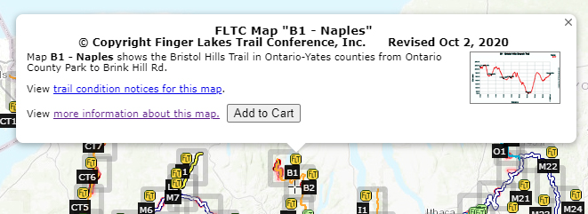
The FLTC sells these maps printed on paper, and as digital downloads in PDF and GPX formats. There are currently 65 maps available that cover the entire FLT System. Most FLTC paper/PDF maps have a scale of 1 inch to the mile, while a few loop trail maps are scaled 3 inches to the mile or less. Each map has detailed descriptions of one section of the trail and indicates mileages from point to point.
FLTC maps indicate county boundaries and topographic quadrangle map names to assist you in acquiring the correct county or topographic map. The FLTC does not sell county or USGS maps.
- County road maps are available for all counties in which the FLT System is located. County maps are helpful in finding back roads and may provide other useful information as well. They are usually more up-to-date than the USGS topographic maps, but do not have contour lines.
- USGS (U.S. Geological Survey) topographic maps are available locally from sporting goods and book stores and from USGS Map Sales, Box 25286, Denver, CO 80225. The trails of the FLT system do not appear on USGS maps.
GPS data for handheld units
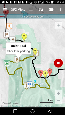
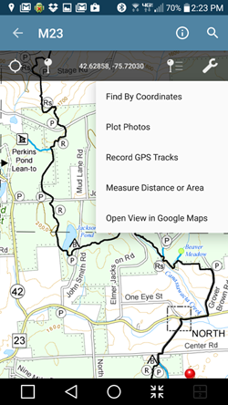
The FLT Store sells GPS tracks and waypoints in downloadable files that cover the entire length of the Main Trail and all of the branch trails. This data can be transferred to compatible GPS units so you can follow your progress as you hike the trail. In addition, the data can also be imported into many mapping programs to help you plan your hike. Read the description in the store to see if the data is compatible with your GPS unit.
Trailhead coordinates for trailheads with parking
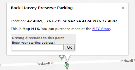
You can find the latitude and longitude coordinates trailheads with parking by clicking on the “parking” icons on the Interactive maps. Coordinates are shown as decimal degrees and as degrees and decimal minutes.
To see coordinates for all trailheads with parking in the FLT system, download one of the files below. One of these formats may be used to upload waypoints to your GPS device, smart phone, or automotive navigation system. Consult with the documentation for your device on upload formats and procedures.
Keep in mind that some trailheads are on seasonal or limited maintenance roads and may not be accessible by vehicles in some weather conditions.
| File name | Size | Date |
|---|---|---|
| FLT Trailheads Google Maps.html | 0 kB | 12-20-2021 |
| FLT Trailheads.csv | 69 kB | 3-01-2025 |
| FLT Trailheads.gpx | 107 kB | 8-27-2022 |
| FLT Trailheads.pdf | 211 kB | 3-01-2025 |
| FLT Trailheads.xlsx | 85 kB | 3-01-2025 |
For other types of automobile GPS units, or to view the locations on your computer, you can download the GPX file (flt Trailheads.gpx) that contains the parking locations. You will need to read the instructions for your GPS unit to determine if you can use this file, and how to transfer it to your GPS unit or mobile device.
For instructions on how you can create your own Google Maps FLT trailheads read FLT Trailheads to Google Maps. For instructions on how to put FLT trailheads on your Garmin Nuvi automotive GPS unit read FLT Trailheads on Garmin Nuvi Automotive GPS units.

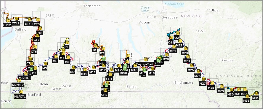



 This is an overview map of the Finger Lakes Trail System. It shows tracks of the main trail, branch trails, loops and spurs. The track colors represent the blaze colors for the branch trails, loops, spurs, and sections of the main FLT not blazed in white. Most of the main FLT is depicted in black & white for better visibility on various map backgrounds, but blazed in white on the ground. Trail closures (hunting, logging, etc.) and recommended bypass routes are depicted as shown at right. Hover over a track to display the name and length. Tracks colored
 This is a overview map of the Finger Lakes Trail System. It shows tracks of the main trail, branch trails, loops and spurs. The track colors represent the blaze colors for the branch trails, loops, spurs, and sections of the main FLT not blazed in white. Most of the main FLT is depicted in black & white for better visibility on various map backgrounds, but blazed in white on the ground. Trail closures (hunting, logging, etc.) and recommended bypass routes are depicted as shown at right. Hover over a track to display the name and length. Tracks colored
