North Country National Scenic Trail Day Celebration
Saturday, September 24, 2016
On the last Saturday of each September, the North Country National Scenic Trail Association holds a “Trail Day Celebration” whereby each of the member clubs sponsors one or more hikes somewhere along their section of the North Country Trail. The NCT runs from North Dakota across the northern United States to Champlain Lake Bridge to Vermont at the Crown Point NY State Historic Site which is north of the Crown Point village and also north of Ticonderoga, NY. Plans are in place to extend the trail into Vermont.
The NCT is carried on the Finger Lakes Trail system from the Pennsylvania border in Allegany State Park to Central New York in Madison County.


2016 National Scenic Trails Day in New York State
Join us as we celebrate the 3RD Annual North Country National Scenic Trail (NCNST) Day on Saturday, September 24, 2016.
422 miles of the NCNST are hosted by the FLT as it crosses NY state along FLT Maps M1 – M21, O1 & O2. If you would like to lead a hike of any length on September 24 to celebrate these premier hiking trails please contact [email protected].
It is also annual Public Lands Day and much of our trail is on public lands. Perhaps we can also help some hikers complete their “NCT Hike 100 Challenge” with a hike on this day, as well! 
Here are the events scheduled as of now:
- There will be an ADK-Onondaga hike offered to Pillsbury Lake Lean-to in West Canada Lakes Wilderness, 7 miles. The trailhead is north of Speculator. The group will be hiking on the former tromping grounds of famous guide and character, French Louis. Lunch will be at the lean-to on picturesque Pillsbury Lake. If interested contact [email protected].
- ADK-Onondaga is also sponsoring a hike on FLT Map O2, NCT/FLT Onondaga Trail, in the New Woodstock area, Smith Rd. to Fairbanks Rd., 4 miles. Most of the hike is in mature hardwood forest, over a scenic ridge and across an open valley. Contact [email protected].
- The Finger Lakes Trail Conference is offering a hike at the western end of the NCNST in NYS from Allegany State Park Road 3 (ASP3) to Bay State Road, FLT Map M1 Access 4 to Access 8. This is a nice hike, 11.5 miles with a rise of 500 feet over the first mile, meanders around 2000 feet in elevation until we near the end where we have a steep downhill descent of 800 feet to the end. Contact Mike Schlicht [email protected] will be meeting at 8:30am at FLT Map 1, Access 8 (Bay State Road) and carpooling to Map 1, Access 4 (ASP3). Bay State Road is exit 19 off of Rt. 86 in Salamanca, NY. Bay State Road will be immediately to your right as you exit the off the ramp from exit 19. Look for the trail access point on your left about ¼ mile down the road.
- The Cayuga Trails Club has scheduled two hikes in the Watkins Glen area (FLT maps M15 and M16). Both hikes belong to the most beautiful in our area and offer a lot of scenic views of Seneca Lake and Watkins Glen and its water falls. Both hikes will start at the Finger Lakes Trail on Templar Road, proceed along the beautiful Glen Creek and through Watkins Glen State Park.The 6 mile hike short hike rated “moderate” will end in Watkins Glen where all hikers can make a stop at the neat Crooked Rooster bar and/or get ice cream at one of the tourist shops.The 12 mile hike mile hike considered “strenuous” will continue through Watkins Glen and along Seneca Lake before heading up steeply through the gorgeous Excelsior Glen all the way up to Burdett and end at Satterly Hill Road.
For more information, visit the CTC website.
More events and more details will follow.
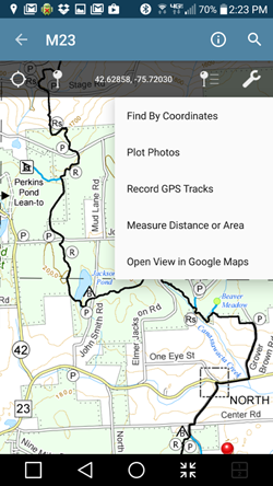

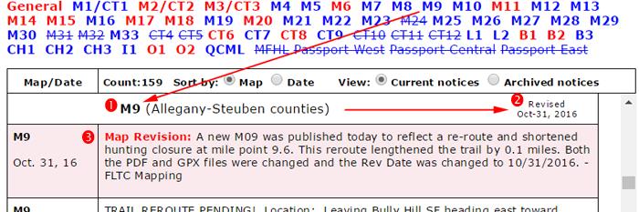
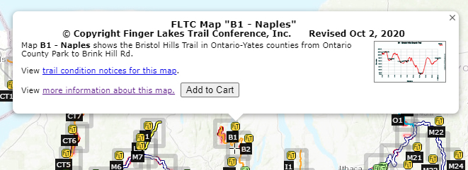

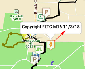
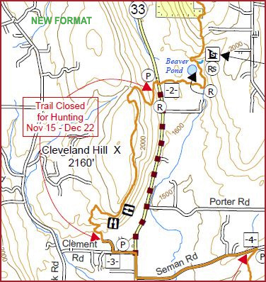
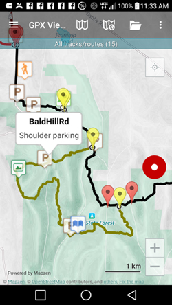
 This is an overview map of the Finger Lakes Trail System. It shows tracks of the main trail, branch trails, loops and spurs. The track colors represent the blaze colors for the branch trails, loops, spurs, and sections of the main FLT not blazed in white. Most of the main FLT is depicted in black & white for better visibility on various map backgrounds, but blazed in white on the ground. Trail closures (hunting, logging, etc.) and recommended bypass routes are depicted as shown at right. Hover over a track to display the name and length. Tracks colored
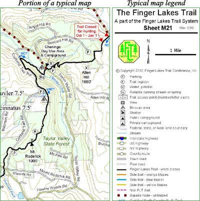
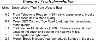
 This is a overview map of the Finger Lakes Trail System. It shows tracks of the main trail, branch trails, loops and spurs. The track colors represent the blaze colors for the branch trails, loops, spurs, and sections of the main FLT not blazed in white. Most of the main FLT is depicted in black & white for better visibility on various map backgrounds, but blazed in white on the ground. Trail closures (hunting, logging, etc.) and recommended bypass routes are depicted as shown at right. Hover over a track to display the name and length. Tracks colored